Japan / Apr 2026
Tokyo to Nagasaki, by air and rail.
An edited route note with city bases, rail gaps, walking days, weather, food streets, and arrival tempo.

Tokyo to Nagasaki, by air and rail.
This is the first public route note. It is still a compact piece: edited maps, selected photographs, and the outline of the trip before the longer essay exists.
The route moves from Tokyo scale to Fukuoka ease, then to Nagasaki's hills and weather. The point here is not to publish every stop. It is to keep enough shape that a later essay can attach food streets, rooms, museums, rain, train gaps, and the small frictions that make the trip memorable.
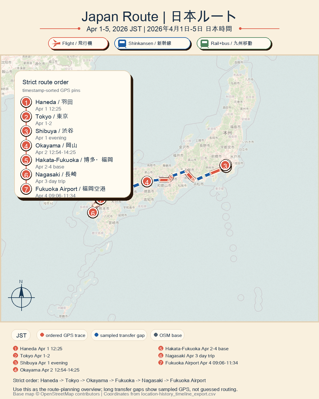
Route logic.
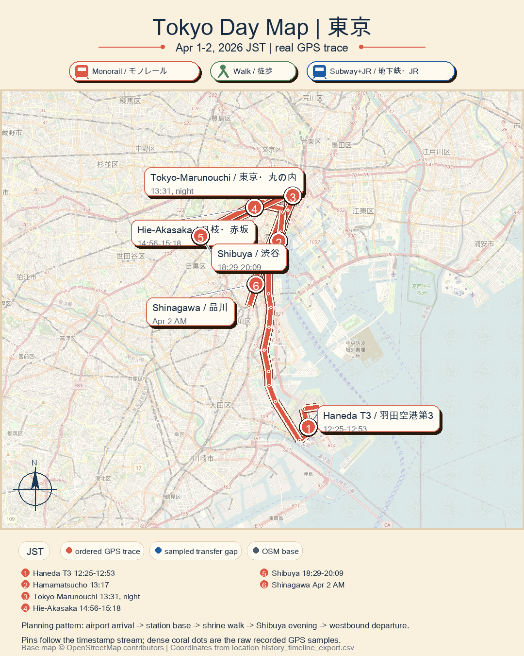
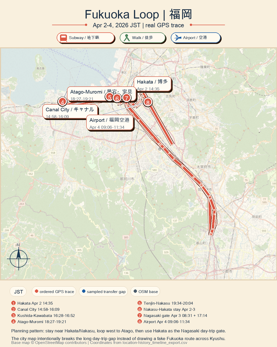
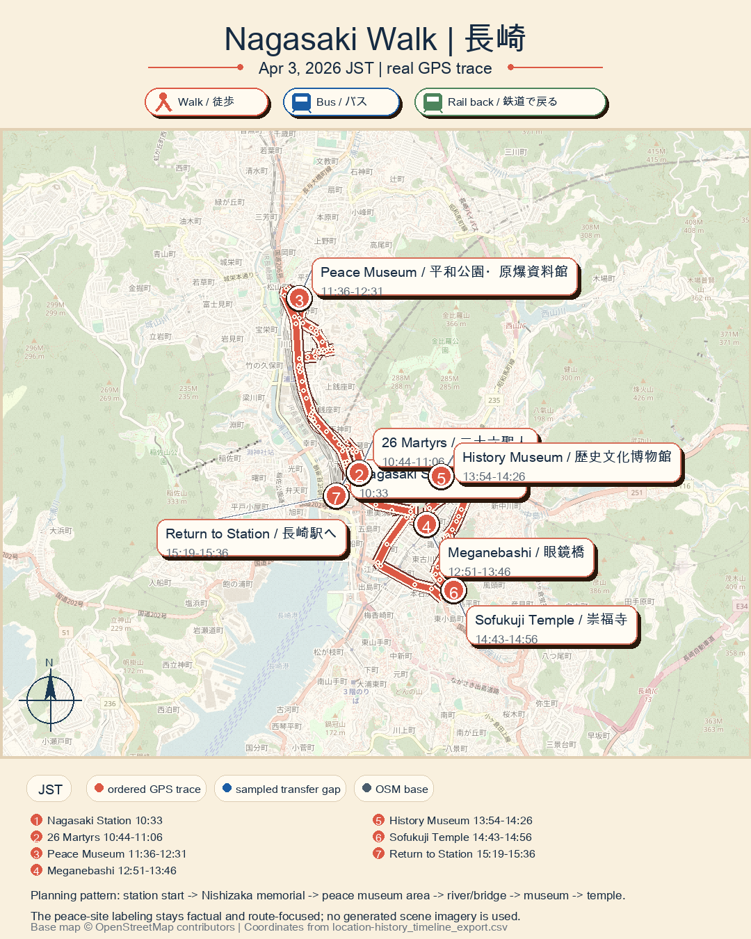
City snapshots.
Future writing.
This page will become a fuller essay when the scenes are written. For now it stays honest as a route note: city anchors, transfer logic, and visual material that can support the longer piece later.